Skip to content
SprayCopter autonomous agricultural UAV (SAV)

Advanced Unmanned Aerial Systems

Drones thatthink, sprayand defend.

Autonomous UAVs for Agriculture and Defence. Certified, field-tested and designed in India.

  • ESTABLISHED

    0

    Incorporated

  • HERITAGE

    0+yrs

    Group legacy

  • INNOVATION

    0+

    Patents published

  • PLATFORMS

    0

    Products

  • CERTIFICATION

    DGCA

    Type-certified

00About SAV

Precision-built aerial systems. Engineered in India.

Designed in India
Autonomous UAVs for Agriculture and Defence, certified and field-tested.
Backed by legacy
Incorporated in 2023 with 57+ years of group legacy.
Indigenous IP
Every patent is developed in-house by our engineering team.
Mission range
From DGCA type-certified spraying to Indian Army-tested surveillance.

01Core Technology

Intelligence in every airframe

Our IP lives in algorithms, sensor fusion and AI models. Processing happens onboard, so our drones keep working where conventional systems lose capability.
SYSTEM / 01Sense
RF INTELLIGENCESTEREO VISIONIMUTERRAIN RADAR
Conceptual visualisation

02Agriculture

SprayCopter

The autonomous agronomy engine. DGCA type-certified.
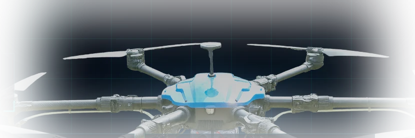
SprayCopter DGCA type-certified agricultural drone
DGCA Type-certified
AUTO FLIGHT PATH · SPRAY COVERAGE

Pick the crop and stage

Set automatically for Wheat

  • Altitude

    Auto

  • Speed

    Auto

  • Application rate

    Auto

  • Droplet size

    Auto

  • Flight path

    Auto

  1. 01Pick the crop and stage; the drone sets altitude, speed, rate, droplet size and path
  2. 02Cloud-synced parameters for wheat, rice, cotton and sugarcane
  3. 03Terrain radar, flow, wind and tank-level feedback loop
  4. 04Zero manual configuration, automatic altitude hold

Feedback loop

  • Terrain radar
  • Flow
  • Wind
  • Tank level
15 min
Endurance
DGCA
Certified
Auto
Altitude hold

03Defence & Security

Field-proven surveillance

SOORYADRISHTI 2 UAV
SHIPPING
PLATFORM / 01

BVLOS intelligence platform

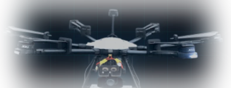
SOORYADRISHTI 2

AI human and vehicle tracking, detect-and-avoid stack and AES-256 encrypted link.

  • AI human & vehicle tracking
  • Detect-and-avoid stack
  • AES-256 encrypted link
Range
10 km
Endurance
40 min
SHADOW UAV
SHIPPING
PLATFORM / 02

Tested by the Indian Army

SHADOW

Dual EO and thermal payload with onboard edge AI. True day and night coverage.

  • Dual EO & thermal payload
  • Onboard edge AI
  • Day & night coverage
Endurance
60 min
Detection
5 km

04Tactical Platforms

Accurate. Reliable. Commanded.

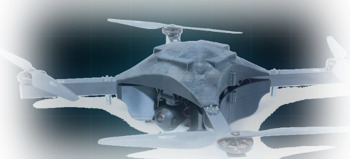
  • SAV-TAC-01SHIPPING
    SAV Polaris Tactical UAV
    4K Thermal · AI Tracking
    01/04

    SAV Polaris Tactical

    AI vehicle and human tracking, 4K thermal

    Endurance40 min
    Speed20 m/s
    AGL120 m
    MSL4000 m
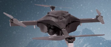
  • SAV-TAC-02SHIPPING
    SAV Nova Reaper UAV
    Autonomous Multi-Payload
    02/04

    SAV Nova Reaper

    Autonomous multi-payload release, 4K thermal

    Endurance40 min
    Speed20 m/s
    AGL120 m
    MSL4000 m
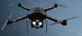
  • SAV-TAC-03SHIPPING
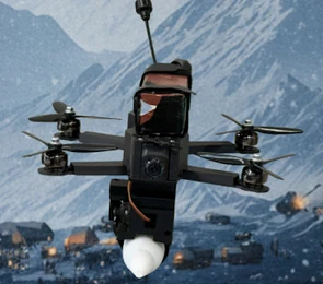
    SAV DropStrike UAV
    High-Altitude Cargo Drop
    03/04

    SAV DropStrike

    Autonomous payload drop, high-altitude ops

    Endurance15–20 min
    Speed25 m/s
    AGL500 m
    MSL4000 m
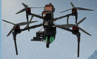
  • SAV-TAC-04SHIPPING
    SAV Talon Strike UAV
    Rapid Strike & Release
    04/04

    SAV Talon Strike

    Fast autonomous payload drop platform

    Endurance15–20 min
    Speed25 m/s
    AGL120 m
    MSL2500 m

05Command & Control

Cognix Command Center

A fully indigenous command centre to plan, monitor and control autonomous defence missions across the fleet.
Cognix // Fleet view
Illustrative interface
UAV-AUAV-BUAV-CUAV-D
Mode: Monitor

Mission status

  • UAV-APlanned
  • UAV-BIn mission
  • UAV-CIn mission
  • UAV-DStandby

System

Cognix Command Center start screen

Cognix Command Center start screen. The fleet view above is a conceptual illustration, not a product screenshot.

06Airborne EW · Electronic Warfare

See the RF environment, from the air

Payload In DevelopmentTarget Field Ops: Q4 2026
SYSTEM STATUS: AIRBORNE SIGINT OPERATIONAL
01 // Bearing Direction
248° WSW
Azimuth ±0.8° Precision
Status:CALIBRATED
02 // Detection Band
2.4 & 5.8 GHz
ISM / Dual-Band Concurrent
Status:MULTI-CHANNEL
03 // Signal Strength
-64 dBm
RSSI: 4.8 / 5.0 High Gain
Status:STRONG
04 // AI Confidence
98.7%
UAV Signature Confirmed
Status:HIGH MATCH
RF Spectrum Telemetry · Live
● RECEPTION 100%
Target Bands:
400 MHz1.0 GHz2.4 GHz (ISM)3.8 GHz5.8 GHz (Video)
Waterfall Signature StreamHistory (t - 60s)
Sweep: 400 MHz – 6 GHzDetections Active: 04
N
360° Direction FindingCALIBRATED

Azimuth DF Array · 4 Emitters in Antenna Range

C-UAS INTERCEPTREADY (STANDBY)
FREQ AGILITY<50ns HOPPING
COVERAGE15+ KM BVLOS

Live spectrum monitoring and automatic drone detection in one operator view. Every detection is logged with bearing, band, signal strength and confidence.

Live Detections FeedAuto-Ranked by Threat
SAV-TRK-01
Commercial Micro-UAV
2.437 GHz (Ch 6)
248° WSW · -64 dBm
HIGH
SAV-TRK-02
High-Band Video Feed
5.765 GHz (Ch 3)
082° ENE · -78 dBm
MONITORED
SAV-TRK-03
Telemetry Beacon Link
868.10 MHz
314° NW · -89 dBm
LOW
SAV-TRK-04
Authorized Friendly SAV
433.05 MHz
176° S · -52 dBm
WHITELIST
Protocol: SAV-EW-V2Target Lock: Synchronized

07Navigator X · Coming Soon

GPS-denied navigation

Stereo vision, visual-inertial odometry and map-based localisation keep drones on course where GNSS is jammed or unavailable.
Coming soon
  • VIO

    Visual-inertial

  • Stereo

    Depth vision

  • Retrofit

    Any UAV

GNSS denied
LOC 1LOC 2LOC 3STEREO · VIO · MAP-BASED LOCALISATION
Illustrative

08Hydrone

Hydrogen endurance, 3.7 hours

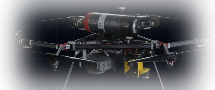
A hydrogen fuel-cell platform with an in-house stack. About 40 minutes on battery becomes 3.7 hours, refuelled in under 5 minutes.
On battery
About 40 min
Hydrone fuel cell
3.7 hrs
Hydrone hydrogen fuel-cell hexacopter prototype
Prototype, in test
Fuel cell
4 kW PEM
Endurance
3.7 hrs
Refuel
< 5 min
Configuration
Hexacopter
Status
Prototype, in test

10 Patents · Published / filed

32 patents across 8 field areas

32PATENTS85444322

8 patents

Hydrogen & Energy

Storage, refuelling, thermal, energy management

13Industries

One platform family, many missions

  • 01

    Agriculture

    Precision spraying for farmers, co-operatives and service operators.

  • 02

    Defence

    ISR, surveillance and navigation resilience for armed forces and security agencies.

  • 03

    Survey & Mapping

    Large-area mapping and geospatial intelligence.

  • 04

    Infrastructure

    Border, perimeter, powerline and pipeline inspection.

  • 05

    Logistics

    Last-mile delivery in difficult terrain.

  • 06

    Emergency Response

    Persistent observation and rapid situational awareness.

SAV // Mission

ENGINEEREDFOR DOMINANCE.

Precision-built. Mission-critical. Talk to us about agriculture, defence and enterprise deployments.

14Contact

Talk to the engineers.

Sooryauday Aerial Vehicles

Plot No-40, Sector-68, IMT Faridabad, Haryana 121004